

Catherine's Blog
Subscribe and receive email notifications of new blog posts.
 RSS Feed
16
The $280 Shift in Affordability Every Homebuyer Should Know
If you paused your plans to move because of high rates or prices, it may finally be time to take a second look at your numbers. Affordability is improving in 39 of the top 50 markets, according to First American. And that's the 5th straight month where buying a home has started to get a little bit easier.
Let's break this down into real dollars, so you can see the difference this could make for you (and your move).
Monthly Payments Are Coming Down
One of the clearest signs of this shift is in monthly payments. The latest data from Redfin shows mortgage payments on a median-priced home are now $283 lower than they were just a few months ago (see graph below):
9
Don't Let Unrealistic Pricing Cost You Your Move
These days, you're going to want to get your price right when you get ready to sell your house. Honestly, it's more important than ever. Why? While you may want to list high just to see what happens, that's a plan that can easily backfire, and it's going to cost you in today's market.
And the risk isn't just missing out on offers, it's missing out on the move you needed to make in the first place.
The Real Pitfall of Overpricing
Many homeowners remember what their neighbor's house sold for a few years ago, and they want to chase that same sky-high number. The problem is, that was a different market.
Today, there are more homes for sale. Buyers have more options to choose from. They don't have to ge...
8
Bend Premier Real Estate | October 2025 Newsletter
What's in the October 2025 Bend Premier Newsletter?
- Lower Mortgage Rates are Making a Difference
- Pumpkin Pancakes
- Get Spooky While Saving: Budget-Friendly Halloween Decor Ideas
- Carl Lake is a Little Known Hike
- 3 Advantages of Buying a Newly Built Home Today
6
Bend Oregon Real Estate | September 2025 Trends
Lower Mortgage Interest Rates Are Making a Difference for Bend Home Sales
For many Bend real estate brokers, the first half of 2025 had mixed sales results. Home prices moderated, and inventory levels increased. With more homes on the market, buyers had more choices. However, high mortgage interest rates kept many would-be home buyers off the market. Home sales proceeded through the summer at a relatively lower pace than was typical for Central Oregon.
However, the market changed in September. In the beginning of September, mortgage rates dropped below 6.5%. This coupled with more motivation from
3
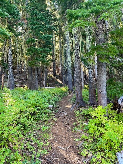
Hike to Carl Lake and Beyond in Oregon's Mt Jefferson Wilderness
The Hike to Carl Lake is Little Known
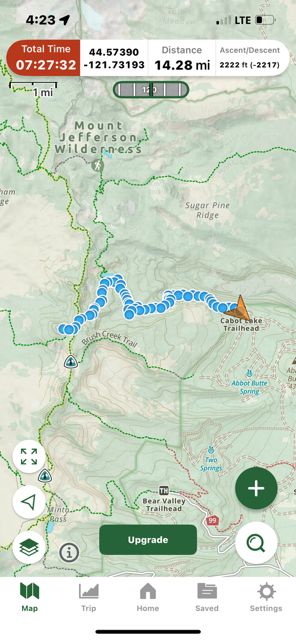
Many in Central Oregon know of the hike to Three Fingered Jack via Canyon Meadow. This trailhead to this hike is accessed from Jack Lake which is at the end of Forest Service Road 1234 in the Mt Jefferson Wilderness. Forest Service Road 1234 splits off Forest Service Road 1230 roughly two miles off paved Jack Lake Road. If instead of turning on 1234 to the Jack Lake Trailhead, people wanting a different experience can continue on 1230 for seven miles to reach the Cabot Lake (Carl Lake) trailhead (the last two miles of this road is rough).
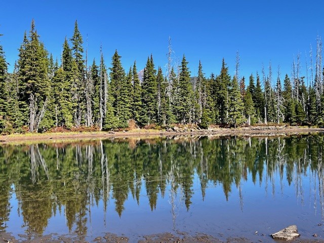
The first mile and a half of this hike is through the recovering burned forest of the B & B complex fire of 2003, but after that, the hike is in old growth forest. Two miles in the trail passes an overgrown and uncleared spur that can take hikers to Cabot Lake, a lovely forest lake. The trail has numerous blueberry bushes and in the fall, interesting mushrooms. After a series of switchbacks climbing a ridge, the trail levels out and passes three small unnamed lakes until at five miles the trail reaches Carl Lake.
 |
 |
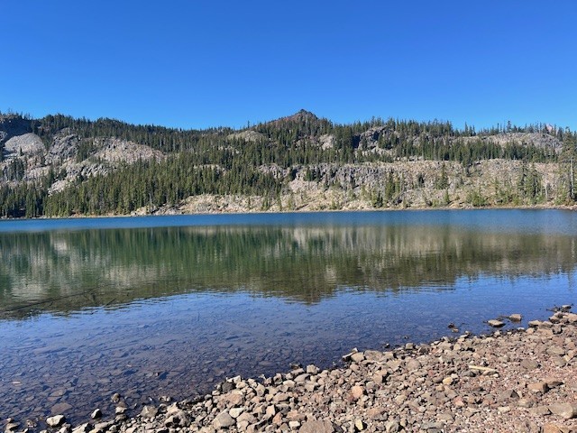
Carl Lake is a lovely, deep blue, glaciated, trout filled alpine lake. There are also many camping spots dotted around the lake for those who wish to spend some time enjoying the area. For those wishing more hiking challenges, past the south side of the lake is a trail that goes to Shirley Lake and beyond it, climbs to reach the Pacific Crest Trail. Two tenths of a mile south on the PCT is a spur trail trail west that hikers can use to summit South Cinder Cone. For those who do, the views toward Mt. Jefferson to the north and Three Fingered Jack to the south are truly outstanding.
 |
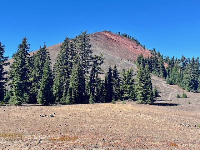 |
Day hikers can enjoy the entire trip from the trailhead up South Cinder Cone and back in 14.28 miles and see very few if any people.
 |
 |
Privacy Policy / DMCA Notice / ADA Accessibility